Trail Walking Sumène - Pinoch - Le Castanet en boucle - Photo

Pinoch - Le Castanet en boucle

 LBarel
LBarel

User

© OpenStreetMap contributors
Length
Length
2.7 km
Max alt
Max alt
549 m
Uphill gradient
Uphill gradient
71 m
Km-Effort
Km-Effort  
3.6 km
Min alt
Min alt
482 m
Downhill gradient
Downhill gradient
74 m
Boucle
Boucle
Yes
Creation date :
2021-07-18 12:45:19.52
Updated on :
2021-07-18 14:06:51.34

(0 Reviews)

Walking
Walking
1h00
Difficulty : Easy

Scan this QR Code to open this trail in the SityTrail application

FREE GPS app for hiking

Logo SityTrail SityTrail

IGN / Geographical institutes

Download SityTrail from the App Store Download SityTrail from Google Play

Logo SityTrail SityTrail World

The world is yours!

Download SityTrail from the App Store Download SityTrail from Google Play Download SityTrail on Huawei AppGallery

About

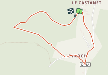
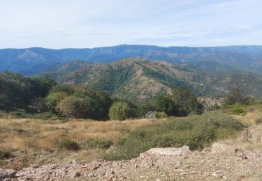
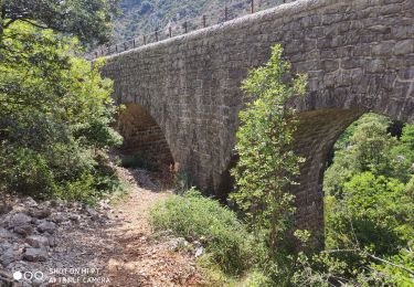
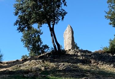
Trail Walking of 2.7 km to be discovered at Occitania, Gard, Sumène. This trail is proposed by LBarel.

Description

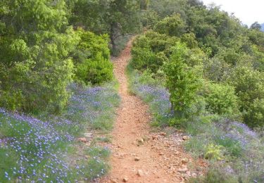
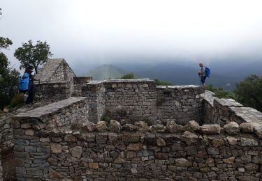
Petite randonnée de 45' qui prend son départ à Pinauch, (contrairement à ce qu'indique le tracé). Se garer dès la bifurcation D11/D11A. Après avoir traversé le hameau sur le GR60, à hauteur de la dernière maison à gauche et juste avant une surface de culture, prendre le sentier qui monte à droite (signe du GR barré). A partir de là une lente montée vers Le Castanet d'où l'on a de belles vues sur la vallée. Du Castanet, descente par la D11.

Elevation profile

Photos

Positioning

Country:
France
Region :
Occitania
Department/Province :
Gard
Municipality :
Sumène
Location:
Unknown
Start:(UTM)
555996 ; 4872639 (31T) N.

Trails nearby

Trail Walking Sumène - Le Ranc de Banes - Sumène - Photo
Walking
tracegps

Walking

Difficult
(1)
Sumène, Occitania, Gard, France
13.3 km | 24 km-effort
6h 0min
Yes
Trail Walking Sumène - Ranc de Banes et les Jumeaux - Photo
Walking
GUIDE
nadinebondoux

Walking

Difficult
Sumène, Occitania, Gard, France
17.6 km | 29 km-effort
6h 8min
Yes
Trail Walking Roquedur - Roquedur - Photo
Walking
hvezinet

Walking

Easy
(3)
Roquedur, Occitania, Gard, France
6.3 km | 10.2 km-effort
2h 16min
Yes
Trail Walking Saint-Martial - Montagne du Liron au départ de St Martial - Photo
Walking
GUIDE
nadinebondoux

Walking

Difficult
Saint-Martial, Occitania, Gard, France
19.4 km | 32 km-effort
7h 4min
Yes
Trail Walking Saint-André-de-Majencoules - Pont d Herault  - Photo
Walking
GUIDE
Roger Philippe Wallez

Walking

Difficult
Saint-André-de-Majencoules, Occitania, Gard, France
20 km | 34 km-effort
6h 52min
Yes
Trail Walking Saint-André-de-Majencoules - les Hameaux de Pont d'Herault variante - Photo
Walking
GUIDE
nadinebondoux

Walking

Difficult
Saint-André-de-Majencoules, Occitania, Gard, France
20 km | 33 km-effort
6h 43min
Yes
Trail Walking Saint-Martial - arsel saint martial  - Photo
Walking
labarone

Walking

Medium
Saint-Martial, Occitania, Gard, France
22 km | 34 km-effort
7h 32min
Yes
Trail Walking Sumène - Sumène - Pont des chèvres - Photo
Walking
LBarel

Walking

Difficult
Sumène, Occitania, Gard, France
10.7 km | 15.3 km-effort
2h 49min
Yes
Trail Walking Saint-Martial - Le col de la Tribale Le col de Bez Saint Martial  - Photo
Walking
boudpn

Walking

(1)
Saint-Martial, Occitania, Gard, France
10.7 km | 15.7 km-effort
5h 22min
Yes


Close
My subscriptions