


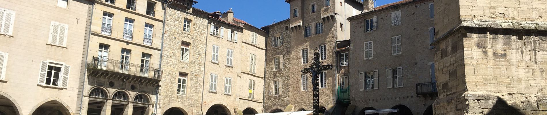
Villefranche de Rouergue

richardsimopons
User
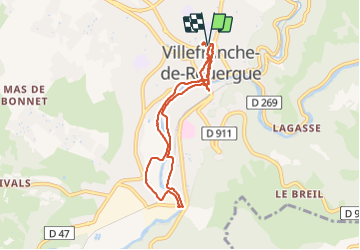

Length
8.7 km

Max alt
291 m

Uphill gradient
86 m
Km-Effort
9.9 km

Min alt
247 m

Downhill gradient
89 m
Boucle
Yes
Creation date :
2021-07-19 07:40:48.0
Updated on :
2021-07-19 11:40:08.85
1h57
Difficulty : Unknown

FREE GPS app for hiking
 SityTrail
IGN / Geographical institutes
SityTrail Plus
The world is yours!
About
Trail Walking of 8.7 km to be discovered at Occitania, Aveyron, Villefranche-de-Rouergue. This trail is proposed by richardsimopons.
Description
De l’hôtel vers le sentier des patrimoines, excellent restaurant le « Jacques a dit » retour hotel.
Photos


Positioning
Country:
France
Region :
Occitania
Department/Province :
Aveyron
Municipality :
Villefranche-de-Rouergue
Location:
Unknown
Start:(Dec)
Start:(UTM)
423266 ; 4911648 (31T) N.
Comments