


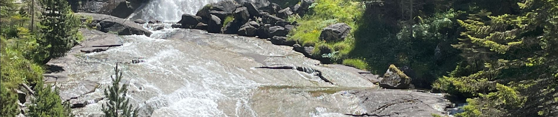
Cascades J1

ETMU5496
User
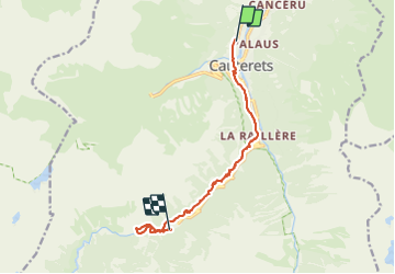

Length
12.3 km

Max alt
1535 m

Uphill gradient
666 m
Km-Effort
19.4 km

Min alt
933 m

Downhill gradient
140 m
Boucle
No
Creation date :
2021-07-19 07:53:36.0
Updated on :
2021-07-19 12:59:43.882
3h01
Difficulty : Easy

FREE GPS app for hiking
 SityTrail
IGN / Geographical institutes
SityTrail Plus
The world is yours!
About
Trail Walking of 12.3 km to be discovered at Occitania, Hautespyrenees, Cauterets. This trail is proposed by ETMU5496.
Photos


35 photos in total. Please click on a photo to see them all in the gallery.
Positioning
Country:
France
Region :
Occitania
Department/Province :
Hautespyrenees
Municipality :
Cauterets
Location:
Unknown
Start:(Dec)
Start:(UTM)
735481 ; 4753213 (30T) N.
Comments