


la croix d Ambel 2021 07 19

verozerr
User
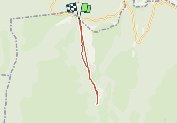

Length
5 km

Max alt
1368 m

Uphill gradient
143 m
Km-Effort
6.9 km

Min alt
1278 m

Downhill gradient
144 m
Boucle
Yes
Creation date :
2021-07-19 13:11:44.399
Updated on :
2021-07-19 15:01:21.931
1h48
Difficulty : Medium

FREE GPS app for hiking
 SityTrail
IGN / Geographical institutes
SityTrail Plus
The world is yours!
About
Trail Walking of 5 km to be discovered at Auvergne-Rhône-Alpes, Drôme, Omblèze. This trail is proposed by verozerr.
Description
la croix d ambel
Positioning
Country:
France
Region :
Auvergne-Rhône-Alpes
Department/Province :
Drôme
Municipality :
Omblèze
Location:
Unknown
Start:(Dec)
Start:(UTM)
676347 ; 4974047 (31T) N.
Comments