


Tournaboup-Lac d’Aygues Cluses

hugha
User
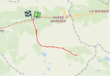

Length
14.4 km

Max alt
2158 m

Uphill gradient
708 m
Km-Effort
24 km

Min alt
1456 m

Downhill gradient
716 m
Boucle
Yes
Creation date :
2021-07-19 11:01:20.0
Updated on :
2021-07-21 10:22:54.749
5h20
Difficulty : Medium

FREE GPS app for hiking
 SityTrail
IGN / Geographical institutes
SityTrail Plus
The world is yours!
About
Trail Walking of 14.4 km to be discovered at Occitania, Hautespyrenees, Barèges. This trail is proposed by hugha.
Positioning
Country:
France
Region :
Occitania
Department/Province :
Hautespyrenees
Municipality :
Barèges
Location:
Unknown
Start:(Dec)
Start:(UTM)
263514 ; 4754143 (31T) N.
Comments