


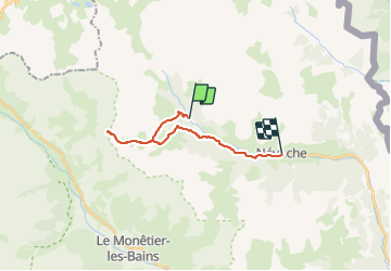
Fontcouverte - Col du Chardonnet - Névache

i20
User

Length
17.3 km

Max alt
2637 m

Uphill gradient
832 m
Km-Effort
29 km

Min alt
1601 m

Downhill gradient
1095 m
Boucle
No
Creation date :
2021-07-23 09:35:05.07
Updated on :
2021-07-23 14:46:13.605
5h10
Difficulty : Difficult

FREE GPS app for hiking
 SityTrail
IGN / Geographical institutes
SityTrail Plus
The world is yours!
About
Trail Walking of 17.3 km to be discovered at Provence-Alpes-Côte d'Azur, Hautes-Alpes, Névache. This trail is proposed by i20.
Positioning
Country:
France
Region :
Provence-Alpes-Côte d'Azur
Department/Province :
Hautes-Alpes
Municipality :
Névache
Location:
Unknown
Start:(Dec)
Start:(UTM)
306647 ; 4989682 (32T) N.
Comments