


Ileou-Pont d’Espagne

ETMU5496
User


6h01
Difficulty : Very difficult

FREE GPS app for hiking
 SityTrail
IGN / Geographical institutes
SityTrail Plus
The world is yours!
About
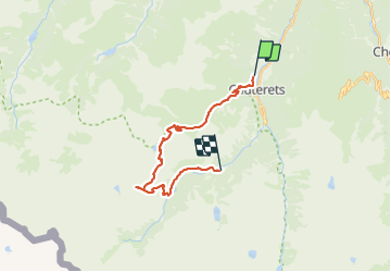
Trail Walking of 22 km to be discovered at Occitania, Hautespyrenees, Cauterets. This trail is proposed by ETMU5496.
Description
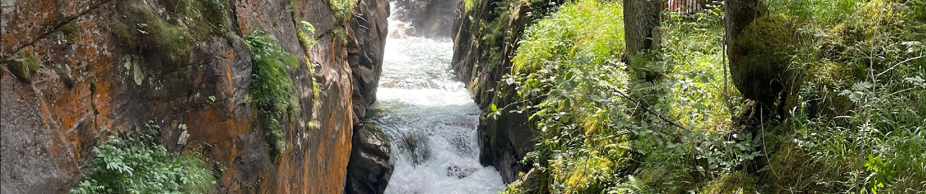
Départ Pavillon des Abeilles à Cauterets. Ascension par le GR jusqu’au refuge d’Ileou.
Poursuite jusqu’au col de Haugade. Puis redescente vers les lacs d’Embarrat, le pont de Cayan.
Emprunter la piste pour rejoindre le refuge du Clôt, le Pont d’Espagne puis le parking en contrebas pour prendre la navette de 17h pour regagner Cauterets et le point de départ.
Photos


57 photos in total. Please click on a photo to see them all in the gallery.
Positioning
Comments