


ACCES PARKING DE LA MOLIERE

TOULAUDIN
User


--
Difficulty : Easy

FREE GPS app for hiking
 SityTrail
IGN / Geographical institutes
SityTrail Plus
The world is yours!
About
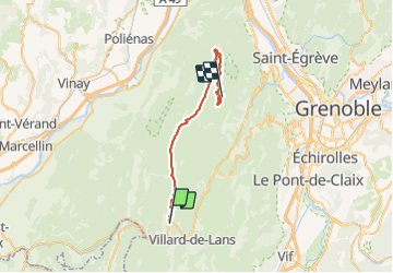
Trail Car of 28 km to be discovered at Auvergne-Rhône-Alpes, Isère, Villard-de-Lans. This trail is proposed by TOULAUDIN.
Description
23/7/21 route pour aller au parking de la Molière
arrivé au tunel, monter sur la gauche route en mauvais état (7KM du TUNEL)
il y a un projet de Navette ,on ne pourra plus monter en voiture
(a suivre auprès de l'offive du tourisme)
Positioning
Comments