


Lac Mandaille

Strabidja
User
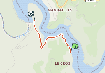

Length
2 km

Max alt
477 m

Uphill gradient
69 m
Km-Effort
2.9 km

Min alt
415 m

Downhill gradient
44 m
Boucle
No
Creation date :
2021-07-26 19:09:25.466
Updated on :
2021-07-26 19:37:20.881
26m
Difficulty : Easy

FREE GPS app for hiking
 SityTrail
IGN / Geographical institutes
SityTrail Plus
The world is yours!
About
Trail Walking of 2 km to be discovered at Occitania, Aveyron, Lassouts. This trail is proposed by Strabidja.
Positioning
Country:
France
Region :
Occitania
Department/Province :
Aveyron
Municipality :
Lassouts
Location:
Unknown
Start:(Dec)
Start:(UTM)
490980 ; 4927354 (31T) N.
Comments