


hetfes totueux

bendoush
User
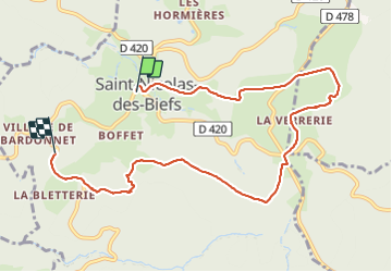

Length
8.9 km

Max alt
1044 m

Uphill gradient
209 m
Km-Effort
12 km

Min alt
804 m

Downhill gradient
279 m
Boucle
No
Creation date :
2021-07-28 10:17:06.114
Updated on :
2021-07-28 13:48:07.201
3h30
Difficulty : Medium

FREE GPS app for hiking
 SityTrail
IGN / Geographical institutes
SityTrail Plus
The world is yours!
About
Trail Walking of 8.9 km to be discovered at Auvergne-Rhône-Alpes, Allier, Saint-Nicolas-des-Biefs. This trail is proposed by bendoush.
Positioning
Country:
France
Region :
Auvergne-Rhône-Alpes
Department/Province :
Allier
Municipality :
Saint-Nicolas-des-Biefs
Location:
Unknown
Start:(Dec)
Start:(UTM)
560476 ; 5101014 (31T) N.
Comments