


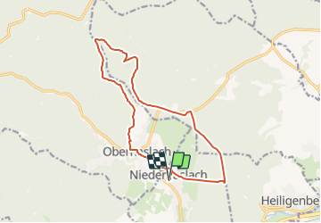
2021-07-28_20h48m15_36-Niederhaslach-St_Florent

geranimo
User

Length
14.3 km

Max alt
669 m

Uphill gradient
501 m
Km-Effort
21 km

Min alt
251 m

Downhill gradient
500 m
Boucle
Yes
Creation date :
2021-07-28 18:48:15.615
Updated on :
2021-07-28 18:49:19.921
36m
Difficulty : Very difficult

FREE GPS app for hiking
 SityTrail
IGN / Geographical institutes
SityTrail Plus
The world is yours!
About
Trail Walking of 14.3 km to be discovered at Grand Est, Bas-Rhin, Niederhaslach. This trail is proposed by geranimo.
Positioning
Country:
France
Region :
Grand Est
Department/Province :
Bas-Rhin
Municipality :
Niederhaslach
Location:
Unknown
Start:(Dec)
Start:(UTM)
377631 ; 5377981 (32U) N.
Comments