


pied Aigu

jphugon
User

Length
16.5 km

Max alt
985 m

Uphill gradient
899 m
Km-Effort
29 km

Min alt
212 m

Downhill gradient
948 m
Boucle
No
Creation date :
2021-07-29 07:07:11.416
Updated on :
2021-07-29 14:23:39.153
7h15
Difficulty : Very difficult

FREE GPS app for hiking
 SityTrail
IGN / Geographical institutes
SityTrail Plus
The world is yours!
About
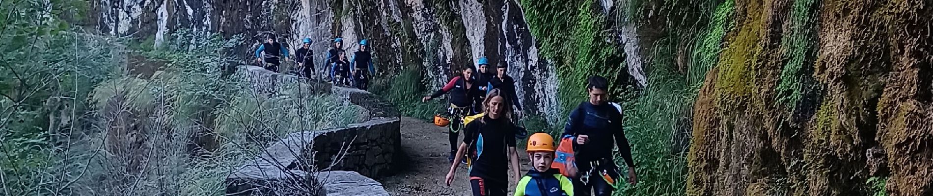
Trail Walking of 16.5 km to be discovered at Auvergne-Rhône-Alpes, Isère, Cognin-les-Gorges. This trail is proposed by jphugon.
Photos


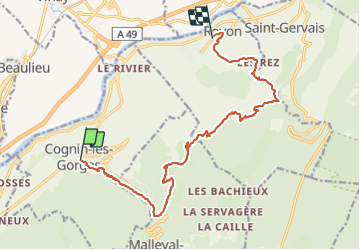
Positioning
Country:
France
Region :
Auvergne-Rhône-Alpes
Department/Province :
Isère
Municipality :
Cognin-les-Gorges
Location:
Unknown
Start:(Dec)
Start:(UTM)
689543 ; 5004666 (31T) N.
Comments