


st denis

dufland
User
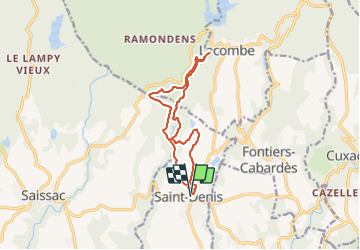

Length
13 km

Max alt
673 m

Uphill gradient
223 m
Km-Effort
15.9 km

Min alt
531 m

Downhill gradient
223 m
Boucle
Yes
Creation date :
2021-07-29 08:10:35.151
Updated on :
2021-07-29 20:05:57.909
4h32
Difficulty : Medium

FREE GPS app for hiking
 SityTrail
IGN / Geographical institutes
SityTrail Plus
The world is yours!
About
Trail Walking of 13 km to be discovered at Occitania, Aude, Saint-Denis. This trail is proposed by dufland.
Positioning
Country:
France
Region :
Occitania
Department/Province :
Aude
Municipality :
Saint-Denis
Location:
Unknown
Start:(Dec)
Start:(UTM)
436760 ; 4801128 (31T) N.
Comments