


Puy de dôme

aemilon
User

Length
5.1 km

Max alt
1416 m

Uphill gradient
2 m
Km-Effort
6.8 km

Min alt
892 m

Downhill gradient
521 m
Boucle
No
Creation date :
2021-07-29 19:26:56.0
Updated on :
2021-07-29 20:34:07.903
1h04
Difficulty : Medium

FREE GPS app for hiking
 SityTrail
IGN / Geographical institutes
SityTrail Plus
The world is yours!
About
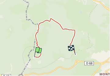
Trail Walking of 5.1 km to be discovered at Auvergne-Rhône-Alpes, Puy-de-Dôme, Orcines. This trail is proposed by aemilon.
Description
Descente de nuit
Photos

Positioning
Country:
France
Region :
Auvergne-Rhône-Alpes
Department/Province :
Puy-de-Dôme
Municipality :
Orcines
Location:
Unknown
Start:(Dec)
Start:(UTM)
497128 ; 5068580 (31T) N.
Comments