


2021-07-30_08h24m01_280

mumu.larandonneuse
User GUIDE
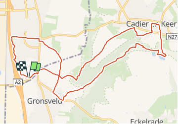

Length
12.6 km

Max alt
137 m

Uphill gradient
134 m
Km-Effort
14.4 km

Min alt
51 m

Downhill gradient
134 m
Boucle
Yes
Creation date :
2021-07-30 06:24:01.936
Updated on :
2021-07-31 17:13:19.152
3h15
Difficulty : Easy

FREE GPS app for hiking
 SityTrail
IGN / Geographical institutes
SityTrail Plus
The world is yours!
About
Trail Walking of 12.6 km to be discovered at Limburg, Unknown, Maastricht. This trail is proposed by mumu.larandonneuse.
Description
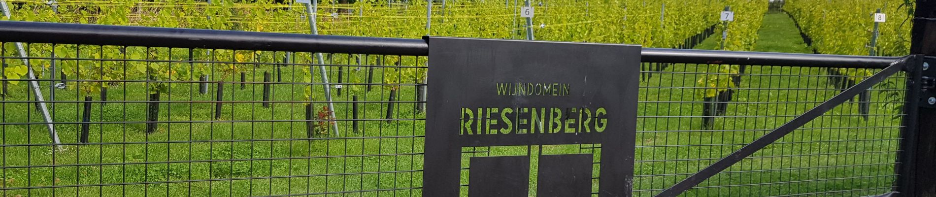
Une boucle de Gronsveld à Cadier en Keer via le Riesenberg.
ℹ Gpx pris sur www.wandelgidszuidlimburg.com n° 280.
Photos


Positioning
Country:
Netherlands
Region :
Limburg
Department/Province :
Unknown
Municipality :
Maastricht
Location:
Unknown
Start:(Dec)
Start:(UTM)
691978 ; 5632915 (31U) N.
Comments
Beau parcours sans difficulté.