Trail Walking Saint-Jean-du-Gard - St jean du Gard - grotte de Rouville - Photo

St jean du Gard - grotte de Rouville

 Bart2015
Bart2015

User

© OpenStreetMap contributors
Length
Length
17.8 km
Max alt
Max alt
497 m
Uphill gradient
Uphill gradient
710 m
Km-Effort
Km-Effort  
27 km
Min alt
Min alt
161 m
Downhill gradient
Downhill gradient
714 m
Boucle
Boucle
Yes
Creation date :
2021-07-30 08:51:41.315
Updated on :
2021-08-28 07:01:26.494

(0 Reviews)

Walking
Walking
5h57
Difficulty : Difficult

Scan this QR Code to open this trail in the SityTrail application

FREE GPS app for hiking

Logo SityTrail SityTrail

IGN / Geographical institutes

Download SityTrail from the App Store Download SityTrail from Google Play

Logo SityTrail SityTrail World

The world is yours!

Download SityTrail from the App Store Download SityTrail from Google Play Download SityTrail on Huawei AppGallery

About

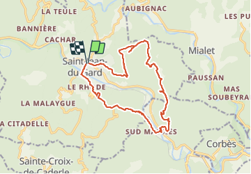
Trail Walking of 17.8 km to be discovered at Occitania, Gard, Saint-Jean-du-Gard. This trail is proposed by Bart2015.

Description

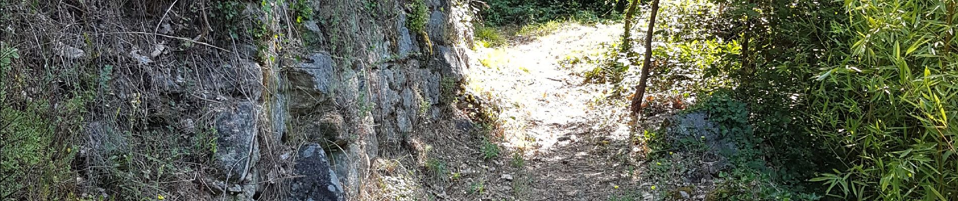
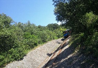
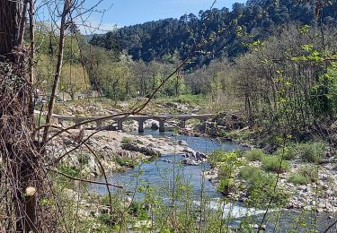
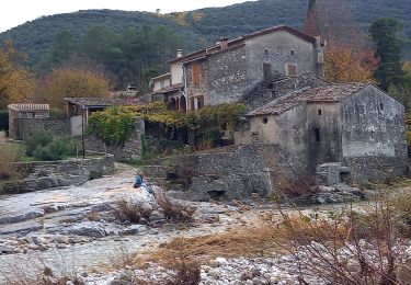
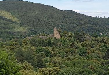
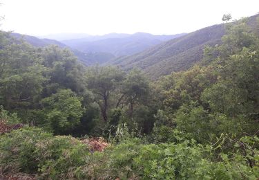
St Jean du Gard petit village des Cévennes point de départ de cette rando nous conduit par un magnifique sentier à la grotte de Rouville, puis redescente sur les rives du Gardon pour une petite pause. Retour à St Jean et s'il n'est pas trop tard, enchaîner par la visite du Musée des vallées Cévenoles qui donne à comprendre la vie, le savoir-faire et l’histoire des Cévennes (prévoir 1h30 mini).
Finir par un hamburger sur le parking près de la Poste ?
Bonne randonnée ...

Elevation profile

Photos

32 photos in total. Please click on a photo to see them all in the gallery.

Positioning

Country:
France
Region :
Occitania
Department/Province :
Gard
Municipality :
Saint-Jean-du-Gard
Location:
Unknown
Start:(UTM)
570930 ; 4884097 (31T) N.

Trails nearby

Trail Walking Thoiras - chemin des ecoliers THOIRAS - Photo
Walking
rocheteau7

Walking

Easy
(2)
Thoiras, Occitania, Gard, France
8.8 km | 12.2 km-effort
2h 20min
Yes
Trail Walking Saint-Jean-du-Gard - Signal Saint Pierre  - Photo
Walking
GUIDE
nadinebondoux

Walking

Medium
Saint-Jean-du-Gard, Occitania, Gard, France
17.7 km | 26 km-effort
4h 44min
No
Trail Walking Mialet - Sentier de Roquefeuil- Mas Soubeyran - Photo
Walking
GUIDE
nadinebondoux

Walking

Medium
Mialet, Occitania, Gard, France
17 km | 26 km-effort
5h 7min
Yes
Trail Walking Soudorgues - Vallée Salindrenque - Photo
Walking
GUIDE
nadinebondoux

Walking

Difficult
Soudorgues, Occitania, Gard, France
19.4 km | 30 km-effort
6h 20min
Yes
Trail Walking Peyrolles - la Diligence  - Photo
Walking
GUIDE
nadinebondoux

Walking

Medium
Peyrolles, Occitania, Gard, France
15.3 km | 0 m-effort
4h 47min
Yes
Trail Walking Saint-Jean-du-Gard - visite st jean du gard et de son train en attendant le bus pour Ales 1.50  - Photo
Walking
Nathalie. Mercier

Walking

Very easy
Saint-Jean-du-Gard, Occitania, Gard, France
3.8 km | 4.2 km-effort
1h 5min
No
Trail Walking Saint-Jean-du-Gard - 17-05-2023 E12 Saint Jean du Gard - Ales  - Photo
Walking
GUIDE
Kargil

Walking

Very difficult
Saint-Jean-du-Gard, Occitania, Gard, France
30 km | 44 km-effort
10h 1min
No
Trail Walking Mialet - Col Douglas  par Mialet et les Aigladines - Photo
Walking
GUIDE
nadinebondoux

Walking

Difficult
Mialet, Occitania, Gard, France
18.2 km | 28 km-effort
5h 18min
Yes
Trail Walking Mialet - Col d'Uglas par Mialet et les Aigladines - Photo
Walking
GUIDE
nadinebondoux

Walking

Difficult
Mialet, Occitania, Gard, France
18.2 km | 28 km-effort
5h 52min
Yes


Close
My subscriptions