


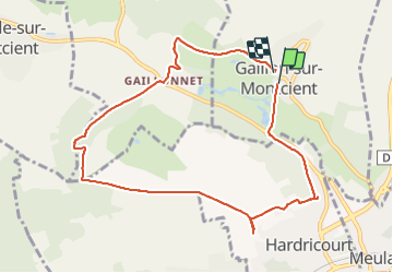
Gaillon Hardricourt en passant par le cimetière

Fky78
User

Length
8.9 km

Max alt
123 m

Uphill gradient
175 m
Km-Effort
11.2 km

Min alt
21 m

Downhill gradient
167 m
Boucle
Yes
Creation date :
2021-07-30 15:50:29.459
Updated on :
2021-07-30 18:46:16.283
2h14
Difficulty : Medium

FREE GPS app for hiking
 SityTrail
IGN / Geographical institutes
SityTrail Plus
The world is yours!
About
Trail Walking of 8.9 km to be discovered at Ile-de-France, Yvelines, Gaillon-sur-Montcient. This trail is proposed by Fky78.
Description
Le stop au cimetière n est pas obligatoire évidemment
Positioning
Country:
France
Region :
Ile-de-France
Department/Province :
Yvelines
Municipality :
Gaillon-sur-Montcient
Location:
Unknown
Start:(Dec)
Start:(UTM)
419015 ; 5430718 (31U) N.
Comments