


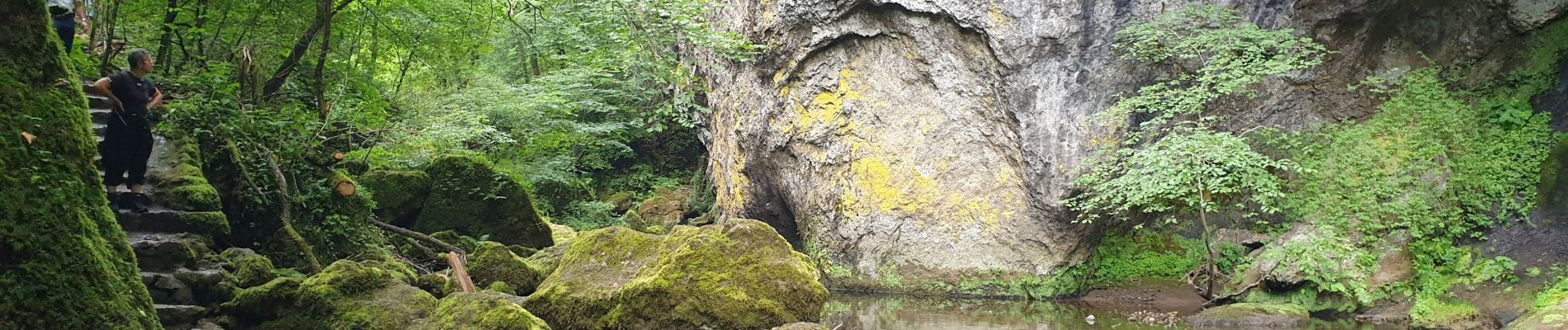
Les Gorges du Pas de Cère

VacheKiri67
User


2h21
Difficulty : Easy

FREE GPS app for hiking
 SityTrail
IGN / Geographical institutes
SityTrail Plus
The world is yours!
About
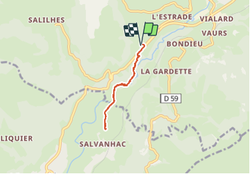
Trail Walking of 4.8 km to be discovered at Auvergne-Rhône-Alpes, Cantal, Thiézac. This trail is proposed by VacheKiri67.
Description
Faite le 30/07/2021. Au départ de l’aire d’accueil du Pas de Cère sur la RN122 près de Thiézac.
Balisage : jaune. Parcours aller-retour.
Forte descente entre le parking et les gorges, donc bonnes chaussures nécessaires.
Il n'est pas nécessaire d'aller jusqu'au parking de Salvanhac pour faire demi-tour comme nous l'avons fait.
Voir https://www.carlades.fr/les-gorges-du-pas-de-cere/
ou https://www.auvergne-destination.com/fiches/sentier-de-decouverte-du-pas-de-cere/
Photos


34 photos in total. Please click on a photo to see them all in the gallery.
Positioning
Comments