


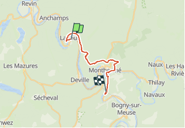
laifour.montherme.2021.07.31

trusgnachjf
User

Length
15.6 km

Max alt
381 m

Uphill gradient
419 m
Km-Effort
21 km

Min alt
126 m

Downhill gradient
424 m
Boucle
No
Creation date :
2021-07-31 09:30:32.314
Updated on :
2021-07-31 15:37:54.272
6h05
Difficulty : Very difficult

FREE GPS app for hiking
 SityTrail
IGN / Geographical institutes
SityTrail Plus
The world is yours!
About
Trail Walking of 15.6 km to be discovered at Grand Est, Ardennes, Laifour. This trail is proposed by trusgnachjf.
Positioning
Country:
France
Region :
Grand Est
Department/Province :
Ardennes
Municipality :
Laifour
Location:
Unknown
Start:(Dec)
Start:(UTM)
621610 ; 5530053 (31U) N.
Comments