


Montée Aigoual et descente par Aire de Côte

Bart2015
User
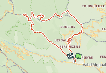

Length
26 km

Max alt
1557 m

Uphill gradient
1328 m
Km-Effort
43 km

Min alt
356 m

Downhill gradient
1327 m
Boucle
Yes
Creation date :
2021-08-02 06:55:12.508
Updated on :
2021-08-27 10:43:08.442
7h18
Difficulty : Very difficult

FREE GPS app for hiking
 SityTrail
IGN / Geographical institutes
SityTrail Plus
The world is yours!
About
Trail Walking of 26 km to be discovered at Occitania, Gard, Val-d'Aigoual. This trail is proposed by Bart2015.
Photos


Positioning
Country:
France
Region :
Occitania
Department/Province :
Gard
Municipality :
Val-d'Aigoual
Location:
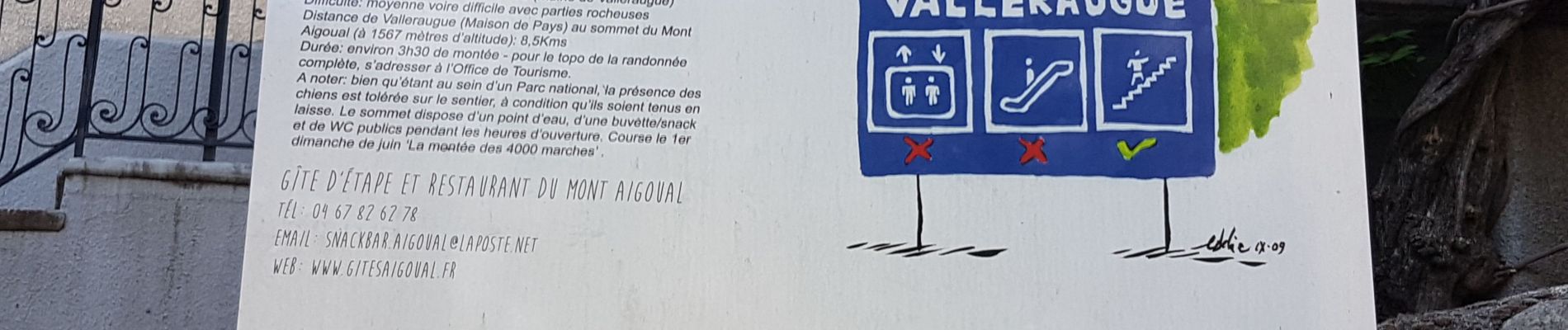
Valleraugue
Start:(Dec)
Start:(UTM)
551365 ; 4881068 (31T) N.
Comments