


Autour de Briançon

arnaudconde
User

Length
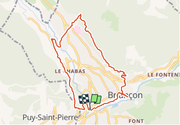
9.7 km

Max alt
1478 m

Uphill gradient
352 m
Km-Effort
14.4 km

Min alt
1205 m

Downhill gradient
351 m
Boucle
Yes
Creation date :
2021-08-03 07:37:25.635
Updated on :
2021-08-03 10:09:29.98
2h06
Difficulty : Difficult

FREE GPS app for hiking
 SityTrail
IGN / Geographical institutes
SityTrail Plus
The world is yours!
About
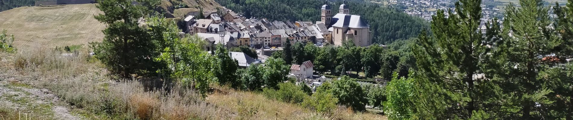
Trail Walking of 9.7 km to be discovered at Provence-Alpes-Côte d'Azur, Hautes-Alpes, Briançon. This trail is proposed by arnaudconde.
Photos


Positioning
Country:
France
Region :
Provence-Alpes-Côte d'Azur
Department/Province :
Hautes-Alpes
Municipality :
Briançon
Location:
Unknown
Start:(Dec)
Start:(UTM)
312961 ; 4973983 (32T) N.
Comments