


Jausiers : Jour 4

jlrayon
User
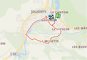

Length
3.3 km

Max alt
1246 m

Uphill gradient
33 m
Km-Effort
3.8 km

Min alt
1211 m

Downhill gradient
33 m
Boucle
Yes
Creation date :
2021-08-05 08:32:53.504
Updated on :
2021-08-05 10:25:43.476
1h15
Difficulty : Easy

FREE GPS app for hiking
 SityTrail
IGN / Geographical institutes
SityTrail Plus
The world is yours!
About
Trail Walking of 3.3 km to be discovered at Provence-Alpes-Côte d'Azur, Alpes-de-Haute-Provence, Jausiers. This trail is proposed by jlrayon.
Positioning
Country:
France
Region :
Provence-Alpes-Côte d'Azur
Department/Province :
Alpes-de-Haute-Provence
Municipality :
Jausiers
Location:
Unknown
Start:(Dec)
Start:(UTM)
320054 ; 4920658 (32T) N.
Comments