


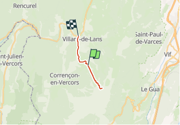
Hidden valley -Villard de Lans

GOHIER
User

Length
11 km

Max alt
1815 m

Uphill gradient
709 m
Km-Effort
21 km

Min alt
961 m

Downhill gradient
903 m
Boucle
No
Creation date :
2021-08-08 13:34:56.0
Updated on :
2021-08-08 15:28:03.293
1h51
Difficulty : Very difficult

FREE GPS app for hiking
 SityTrail
IGN / Geographical institutes
SityTrail Plus
The world is yours!
About
Trail Walking of 11 km to be discovered at Auvergne-Rhône-Alpes, Isère, Villard-de-Lans. This trail is proposed by GOHIER.
Description
Avec Arnaud, Anna et Arnaud
Positioning
Country:
France
Region :
Auvergne-Rhône-Alpes
Department/Province :
Isère
Municipality :
Villard-de-Lans
Location:
Unknown
Start:(Dec)
Start:(UTM)
701615 ; 4991111 (31T) N.
Comments