


20210810 Le Buet Les Granges

Childebert
User
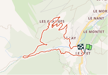

Length
5.8 km

Max alt
1582 m

Uphill gradient
259 m
Km-Effort
9.3 km

Min alt
1335 m

Downhill gradient
259 m
Boucle
Yes
Creation date :
2021-08-10 08:58:02.23
Updated on :
2023-10-02 19:59:38.093
2h06
Difficulty : Medium
3h00
Difficulty : Medium

FREE GPS app for hiking
 SityTrail
IGN / Geographical institutes
SityTrail Plus
The world is yours!
About
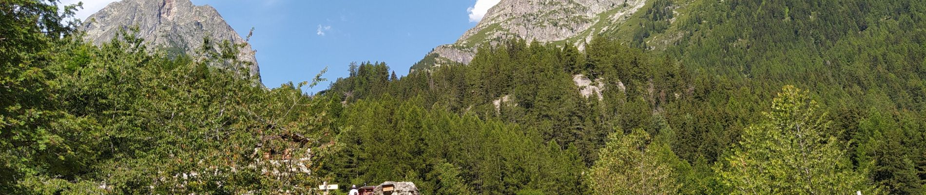
Trail Walking of 5.8 km to be discovered at Auvergne-Rhône-Alpes, Upper Savoy, Vallorcine. This trail is proposed by Childebert.
Photos

Positioning
Country:
France
Region :
Auvergne-Rhône-Alpes
Department/Province :
Upper Savoy
Municipality :
Vallorcine
Location:
Unknown
Start:(Dec)
Start:(UTM)
339027 ; 5098263 (32T) N.
Comments