Trail Walking Fontainebleau - Fontainebleau sentier Denecourt 10 - Photo

Fontainebleau sentier Denecourt 10

 guydu41
guydu41

User

© OpenStreetMap contributors
Length
Length
4.8 km
Max alt
Max alt
123 m
Uphill gradient
Uphill gradient
64 m
Km-Effort
Km-Effort  
5.6 km
Min alt
Min alt
81 m
Downhill gradient
Downhill gradient
64 m
Boucle
Boucle
Yes
Creation date :
2021-08-13 07:18:06.731
Updated on :
2021-08-18 01:18:04.267

(0 Reviews)

Walking
Walking
2h05
Difficulty : Easy

Scan this QR Code to open this trail in the SityTrail application

FREE GPS app for hiking

Logo SityTrail SityTrail

IGN / Geographical institutes

Download SityTrail from the App Store Download SityTrail from Google Play

Logo SityTrail SityTrail Plus

The world is yours!

Download SityTrail from the App Store Download SityTrail from Google Play Download SityTrail on Huawei AppGallery

About

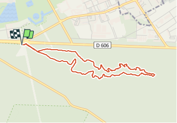
Trail Walking of 4.8 km to be discovered at Ile-de-France, Seine-et-Marne, Fontainebleau. This trail is proposed by guydu41.

Description

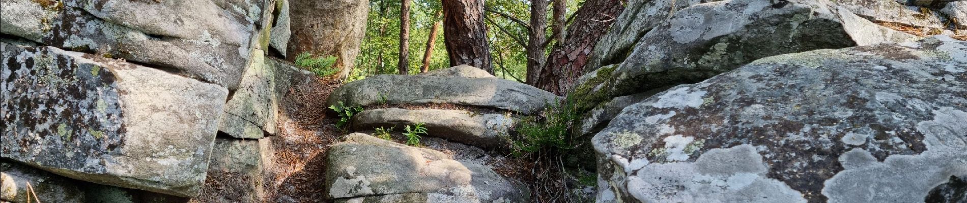
Très beau parcours facile entièrement sur le circuit Denecourt 10.
Plusieurs passages entre rochers, sous des blocs rocheux, à travers une parois rocheuse, à côté de cavernes, de stèles, et de beaux points de vue.
Départ/Arrivée : Parking en face de celui du "Rocher d'Avon" de l'autre côté de la D606.

Elevation profile

Photos

37 photos in total. Please click on a photo to see them all in the gallery.

Positioning

Country:
France
Region :
Ile-de-France
Department/Province :
Seine-et-Marne
Municipality :
Fontainebleau
Location:
Unknown
Start:(UTM)
477938 ; 5360413 (31U) N.


Close
My subscriptions