


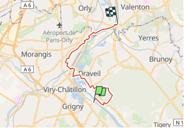
RIS ORANGIS --> VILLENEUVE SAINT GEORGES

gemau77
User

Length
18.7 km

Max alt
95 m

Uphill gradient
212 m
Km-Effort
21 km

Min alt
25 m

Downhill gradient
210 m
Boucle
No
Creation date :
2021-08-14 15:31:22.234
Updated on :
2021-09-04 08:50:45.81
2h25
Difficulty : Medium

FREE GPS app for hiking
 SityTrail
IGN / Geographical institutes
SityTrail Plus
The world is yours!
About
Trail Walking of 18.7 km to be discovered at Ile-de-France, Essonne, Ris-Orangis. This trail is proposed by gemau77.
Description
Traversée du Grand Paris le long de la Seine
7e étape

Positioning
Country:
France
Region :
Ile-de-France
Department/Province :
Essonne
Municipality :
Ris-Orangis
Location:
Unknown
Start:(Dec)
Start:(UTM)
456888 ; 5389764 (31U) N.
Comments