


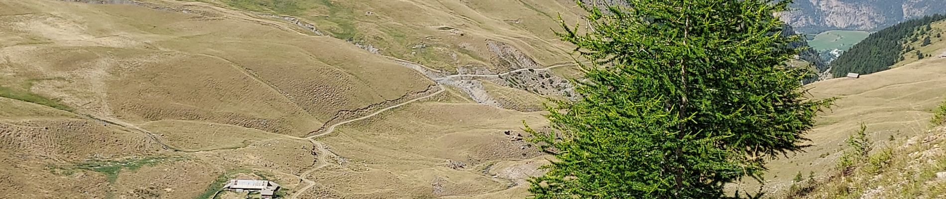
Lac des Terres Pleines. Route de la Bonette

Dervalmarc
User
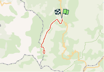

Length
11.2 km

Max alt
2427 m

Uphill gradient
544 m
Km-Effort
18.5 km

Min alt
1910 m

Downhill gradient
545 m
Boucle
Yes
Creation date :
2021-08-16 13:27:48.347
Updated on :
2021-08-16 14:17:02.534
4h12
Difficulty : Difficult

FREE GPS app for hiking
 SityTrail
IGN / Geographical institutes
SityTrail Plus
The world is yours!
About
Trail Walking of 11.2 km to be discovered at Provence-Alpes-Côte d'Azur, Alpes-de-Haute-Provence, Jausiers. This trail is proposed by Dervalmarc.
Description
Randonnée moyenne.Véritable jardin Alpin.
Attentation randonnée tout a l 'adret pas d' ombre tout le long du parcours.
Deux tiers du parcours sentier en balcon.
Photos


Positioning
Country:
France
Region :
Provence-Alpes-Côte d'Azur
Department/Province :
Alpes-de-Haute-Provence
Municipality :
Jausiers
Location:
Unknown
Start:(Dec)
Start:(UTM)
323284 ; 4915647 (32T) N.
Comments