


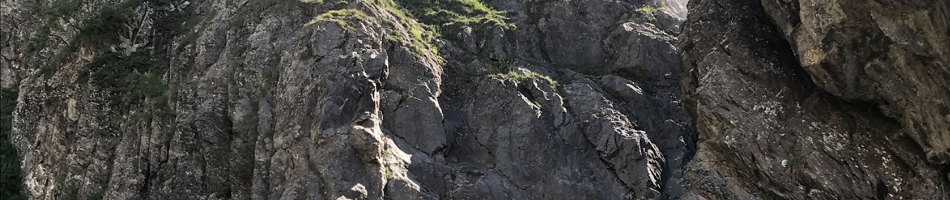
Cascade de la Buffe

GOHIER
User
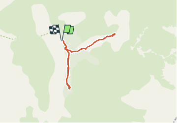

Length
7.9 km

Max alt
1740 m

Uphill gradient
464 m
Km-Effort
14.1 km

Min alt
1306 m

Downhill gradient
461 m
Boucle
Yes
Creation date :
2021-08-16 08:34:08.0
Updated on :
2021-08-16 14:18:48.516
5h43
Difficulty : Medium

FREE GPS app for hiking
 SityTrail
IGN / Geographical institutes
SityTrail Plus
The world is yours!
About
Trail Walking of 7.9 km to be discovered at Provence-Alpes-Côte d'Azur, Hautes-Alpes, La Chapelle-en-Valgaudémar. This trail is proposed by GOHIER.
Description
Famille au complet
Photos

Positioning
Country:
France
Region :
Provence-Alpes-Côte d'Azur
Department/Province :
Hautes-Alpes
Municipality :
La Chapelle-en-Valgaudémar
Location:
Unknown
Start:(Dec)
Start:(UTM)
278588 ; 4964370 (32T) N.
Comments