


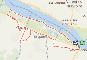
Montsoreau-Turquant Les bords de Loire

JMCMoreau
User

Length
12.7 km

Max alt
78 m

Uphill gradient
162 m
Km-Effort
14.8 km

Min alt
25 m

Downhill gradient
161 m
Boucle
Yes
Creation date :
2021-08-16 16:15:27.836
Updated on :
2021-08-16 16:16:51.618
3h30
Difficulty : Easy

FREE GPS app for hiking
 SityTrail
IGN / Geographical institutes
SityTrail Plus
The world is yours!
About
Trail Walking of 12.7 km to be discovered at Pays de la Loire, Maine-et-Loire, Montsoreau. This trail is proposed by JMCMoreau.
Positioning
Country:
France
Region :
Pays de la Loire
Department/Province :
Maine-et-Loire
Municipality :
Montsoreau
Location:
Unknown
Start:(Dec)
Start:(UTM)
277154 ; 5233445 (31T) N.
Comments