


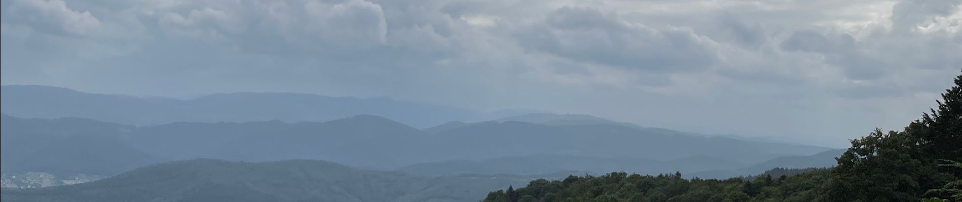
Vers le champ du Feu

francoisecarlier
User
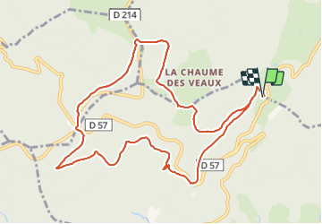

Length
11.1 km

Max alt
1103 m

Uphill gradient
475 m
Km-Effort
17.4 km

Min alt
725 m

Downhill gradient
476 m
Boucle
Yes
Creation date :
2021-08-17 11:09:52.0
Updated on :
2021-08-17 15:05:34.857
3h28
Difficulty : Difficult

FREE GPS app for hiking
 SityTrail
IGN / Geographical institutes
SityTrail Plus
The world is yours!
About
Trail Walking of 11.1 km to be discovered at Grand Est, Bas-Rhin, Breitenbach. This trail is proposed by francoisecarlier.
Photos


Positioning
Country:
France
Region :
Grand Est
Department/Province :
Bas-Rhin
Municipality :
Breitenbach
Location:
Unknown
Start:(Dec)
Start:(UTM)
373623 ; 5360777 (32U) N.
Comments