


BLANDY

jcschubnel
User
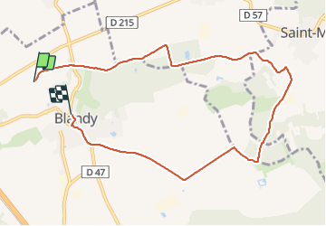

Length
8.9 km

Max alt
100 m

Uphill gradient
69 m
Km-Effort
9.9 km

Min alt
78 m

Downhill gradient
73 m
Boucle
No
Creation date :
2021-08-18 12:46:19.356
Updated on :
2021-08-18 16:03:23.994
2h13
Difficulty : Easy

FREE GPS app for hiking
 SityTrail
IGN / Geographical institutes
SityTrail Plus
The world is yours!
About
Trail Walking of 8.9 km to be discovered at Ile-de-France, Seine-et-Marne, Blandy. This trail is proposed by jcschubnel.
Positioning
Country:
France
Region :
Ile-de-France
Department/Province :
Seine-et-Marne
Municipality :
Blandy
Location:
Unknown
Start:(Dec)
Start:(UTM)
483370 ; 5379894 (31U) N.
Comments