Trail Walking Crots - Fontaine de l'ours et belvederes bragouse - Photo

Fontaine de l'ours et belvederes bragouse

 guariso
guariso

User

© OpenStreetMap contributors
Length
Length
8.7 km
Max alt
Max alt
1598 m
Uphill gradient
Uphill gradient
430 m
Km-Effort
Km-Effort  
14.4 km
Min alt
Min alt
1203 m
Downhill gradient
Downhill gradient
428 m
Boucle
Boucle
Yes
Creation date :
2021-08-19 06:54:17.651
Updated on :
2021-08-19 10:47:53.712

(0 Reviews)

Walking
Walking
3h04
Difficulty : Easy

Scan this QR Code to open this trail in the SityTrail application

FREE GPS app for hiking

Logo SityTrail SityTrail

IGN / Geographical institutes

Download SityTrail from the App Store Download SityTrail from Google Play

Logo SityTrail SityTrail World

The world is yours!

Download SityTrail from the App Store Download SityTrail from Google Play Download SityTrail on Huawei AppGallery

About

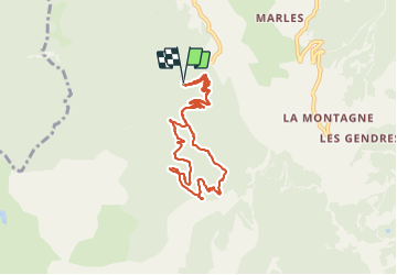
Trail Walking of 8.7 km to be discovered at Provence-Alpes-Côte d'Azur, Hautes-Alpes, Crots. This trail is proposed by guariso.

Description

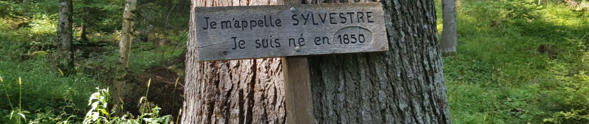
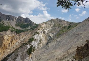
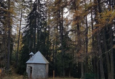
balade en sous bois de pins et mélèzes. durée indiquée avec arrêts aux 3 belvederes

Elevation profile

Photos

Positioning

Country:
France
Region :
Provence-Alpes-Côte d'Azur
Department/Province :
Hautes-Alpes
Municipality :
Crots
Location:
Unknown
Start:(UTM)
297402 ; 4930297 (32T) N.

Trails nearby

Trail Walking Crots - Le Cirque de Morgon - Photo
Walking
tracegps

Walking

Difficult
(5)
Crots, Provence-Alpes-Côte d'Azur, Hautes-Alpes, France
10.6 km | 21 km-effort
5h 30min
Yes
Trail Walking Crots - Morgon par le Grand Clot - Photo
Walking
GUIDE
David25400

Walking

Easy
(1)
Crots, Provence-Alpes-Côte d'Azur, Hautes-Alpes, France
11.8 km | 22 km-effort
5h 49min
Yes
Trail Walking Crots - SityTrail - 2251353 - morgon-par-le-grand-clot - Photo
Walking
GUIDE
amiral13

Walking

Medium
Crots, Provence-Alpes-Côte d'Azur, Hautes-Alpes, France
11.8 km | 22 km-effort
5h 30min
Yes
Trail Walking Crots - Morgon par la fontaine de l'Ours - Photo
Walking
GUIDE
David25400

Walking

Medium
Crots, Provence-Alpes-Côte d'Azur, Hautes-Alpes, France
17.7 km | 33 km-effort
6h 26min
Yes
Trail Mountain bike Savines-le-Lac - circuit de serre verger N°25 - Photo
Mountain bike
guariso

Mountain bike

Medium
(1)
Savines-le-Lac, Provence-Alpes-Côte d'Azur, Hautes-Alpes, France
9.8 km | 15.8 km-effort
1h 30min
No
Trail Walking Crots - col des olettes - Photo
Walking
gildascb

Walking

Easy
(1)
Crots, Provence-Alpes-Côte d'Azur, Hautes-Alpes, France
11.8 km | 23 km-effort
4h 53min
Yes
Trail Touring skiing Crots - Pic de Morgon - Photo
Touring skiing
GUIDE
David25400

Touring skiing

Medium
Crots, Provence-Alpes-Côte d'Azur, Hautes-Alpes, France
20 km | 37 km-effort
6h 35min
Yes
Trail Walking Crots - Lac du Lauzerot en boucle - Photo
Walking
GUIDE
David25400

Walking

Very easy
Crots, Provence-Alpes-Côte d'Azur, Hautes-Alpes, France
5.6 km | 9.2 km-effort
2h 24min
Yes
Trail Walking Crots - lac du Lauzerot 241022 - Photo
Walking
GUIDE
David25400

Walking

Very easy
Crots, Provence-Alpes-Côte d'Azur, Hautes-Alpes, France
6.4 km | 10.1 km-effort
2h 31min
No


Close
My subscriptions