Trail 4x4 Bompas - Raid 4x4 De Lihovskoï août 2021 - Photo

Raid 4x4 De Lihovskoï août 2021

 cbrisou
cbrisou

User

© OpenStreetMap contributors
Length
Length
194 km
Max alt
Max alt
1680 m
Uphill gradient
Uphill gradient
4974 m
Km-Effort
Km-Effort  
261 km
Min alt
Min alt
481 m
Downhill gradient
Downhill gradient
4983 m
Boucle
Boucle
No
Creation date :
2021-08-18 09:48:48.0
Updated on :
2021-08-19 19:45:14.005

(1 Reviews)

4x4
4x4
9h13
Difficulty : Medium

Scan this QR Code to open this trail in the SityTrail application

FREE GPS app for hiking

Logo SityTrail SityTrail

IGN / Geographical institutes

Download SityTrail from the App Store Download SityTrail from Google Play

Logo SityTrail SityTrail World

The world is yours!

Download SityTrail from the App Store Download SityTrail from Google Play Download SityTrail on Huawei AppGallery

About

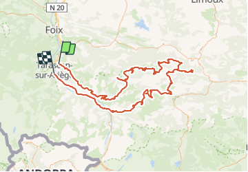
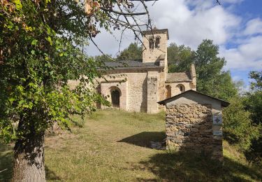
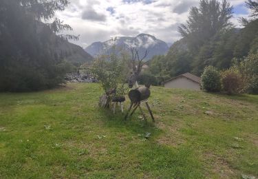
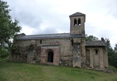
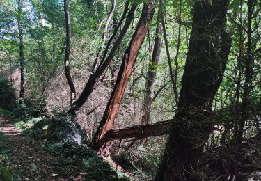
Trail 4x4 of 194 km to be discovered at Occitania, Ariège, Bompas. This trail is proposed by cbrisou.

Description

En deux jours et une nuit.

Elevation profile

Positioning

Country:
France
Region :
Occitania
Department/Province :
Ariège
Municipality :
Bompas
Location:
Unknown
Start:(UTM)
387620 ; 4746513 (31T) N.

Comments

Please log in to post a review or rate the element


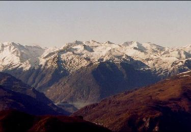
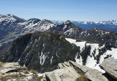
Un tracé splendide. Avec beaucoup de neige attention pour fin février. Être bien équipé ou plusieurs 4x4 car des passages de neige glacé de 60cm à 80cm. Mais sinon magnifique


Trails nearby

Trail Walking Saint-Paul-de-Jarrat - Le Mont Fourcat - Croquié - Photo
Walking
tracegps

Walking

Difficult
(2)
Saint-Paul-de-Jarrat, Occitania, Ariège, France
10.5 km | 20 km-effort
4h 15min
Yes
Trail Running Mercus-Garrabet - mercus1 - Photo
Running
gilbertcaujolle

Running

Very easy
(1)
Mercus-Garrabet, Occitania, Ariège, France
20 km | 37 km-effort
5h 6min
Yes
Trail Walking Mercus-Garrabet - Mont Fourcat en A/R - Photo
Walking
chrisgps

Walking

Easy
Mercus-Garrabet, Occitania, Ariège, France
10 km | 21 km-effort
4h 42min
Yes
Trail Walking Tarascon-sur-Ariège - De Tarascon sur Ariège aux Cabannes  - Photo
Walking
c.chehere

Walking

Medium
Tarascon-sur-Ariège, Occitania, Ariège, France
13.8 km | 17.1 km-effort
5h 4min
No
Trail Walking Tarascon-sur-Ariège - Tour de la pique de Tarrascon - Photo
Walking
c.chehere

Walking

Medium
Tarascon-sur-Ariège, Occitania, Ariège, France
11.9 km | 19.3 km-effort
5h 46min
Yes
Trail Walking Surba - Tour du roc de Sédour - Photo
Walking
c.chehere

Walking

Easy
Surba, Occitania, Ariège, France
13.1 km | 19.5 km-effort
4h 10min
Yes
Trail On foot Arnave - Le Tour de la Pique - Photo
On foot
PRO

On foot

Easy
Arnave, Occitania, Ariège, France
9.9 km | 17.3 km-effort
3h 55min
Yes
Trail Walking Quié - le dolmen de la plagne - Photo
Walking
c.chehere

Walking

Medium
Quié, Occitania, Ariège, France
12.7 km | 21 km-effort
5h 40min
Yes
Trail On foot Montoulieu - La cabane des gardes - Photo
On foot
c.chehere

On foot

Medium
Montoulieu, Occitania, Ariège, France
15.5 km | 25 km-effort
Unknown
Yes


Close
My subscriptions