


refuge matins cime saurel

BELLETGE
User
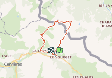

Length
11.9 km

Max alt
2431 m

Uphill gradient
603 m
Km-Effort
19.9 km

Min alt
1865 m

Downhill gradient
603 m
Boucle
Yes
Creation date :
2021-08-18 07:54:01.129
Updated on :
2021-08-20 15:31:51.543
3h47
Difficulty : Very difficult

FREE GPS app for hiking
 SityTrail
IGN / Geographical institutes
SityTrail Plus
The world is yours!
About
Trail Walking of 11.9 km to be discovered at Provence-Alpes-Côte d'Azur, Hautes-Alpes, Cervières. This trail is proposed by BELLETGE.
Positioning
Country:
France
Region :
Provence-Alpes-Côte d'Azur
Department/Province :
Hautes-Alpes
Municipality :
Cervières
Location:
Unknown
Start:(Dec)
Start:(UTM)
323725 ; 4971487 (32T) N.
Comments