


2021-08-22 St Chaffrey

Bernardb44
User

Length
3.7 km

Max alt
1475 m

Uphill gradient
134 m
Km-Effort
5.5 km

Min alt
1334 m

Downhill gradient
135 m
Boucle
Yes
Creation date :
2021-08-22 07:22:33.966
Updated on :
2021-08-22 08:23:44.111
1h00
Difficulty : Very easy

FREE GPS app for hiking
 SityTrail
IGN / Geographical institutes
SityTrail Plus
The world is yours!
About
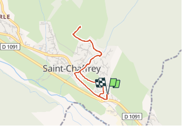
Trail Walking of 3.7 km to be discovered at Provence-Alpes-Côte d'Azur, Hautes-Alpes, Saint-Chaffrey. This trail is proposed by Bernardb44.
Positioning
Country:
France
Region :
Provence-Alpes-Côte d'Azur
Department/Province :
Hautes-Alpes
Municipality :
Saint-Chaffrey
Location:
Unknown
Start:(Dec)
Start:(UTM)
311639 ; 4977187 (32T) N.
Comments