


Odars 2021 fait

pidjam
User
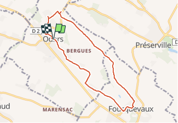

Length
8.9 km

Max alt
238 m

Uphill gradient
115 m
Km-Effort
10.4 km

Min alt
162 m

Downhill gradient
117 m
Boucle
Yes
Creation date :
2021-08-22 07:20:45.62
Updated on :
2021-08-22 09:35:37.154
2h14
Difficulty : Easy

FREE GPS app for hiking
 SityTrail
IGN / Geographical institutes
SityTrail Plus
The world is yours!
About
Trail Walking of 8.9 km to be discovered at Occitania, Haute-Garonne, Odars. This trail is proposed by pidjam.
Positioning
Country:
France
Region :
Occitania
Department/Province :
Haute-Garonne
Municipality :
Odars
Location:
Unknown
Start:(Dec)
Start:(UTM)
386081 ; 4819978 (31T) N.
Comments