


Prat d 'Albis

caccini
User
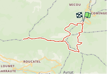

Length
19.2 km

Max alt
1695 m

Uphill gradient
698 m
Km-Effort
28 km

Min alt
1200 m

Downhill gradient
698 m
Boucle
Yes
Creation date :
2021-08-22 07:25:56.977
Updated on :
2021-08-23 16:57:31.664
5h46
Difficulty : Easy

FREE GPS app for hiking
 SityTrail
IGN / Geographical institutes
SityTrail Plus
The world is yours!
About
Trail Walking of 19.2 km to be discovered at Occitania, Ariège, Prayols. This trail is proposed by caccini.
Description
Randonnée
Positioning
Country:
France
Region :
Occitania
Department/Province :
Ariège
Municipality :
Prayols
Location:
Unknown
Start:(Dec)
Start:(UTM)
384250 ; 4753064 (31T) N.
Comments