


Le Mont Guillaume

Clo0413
User
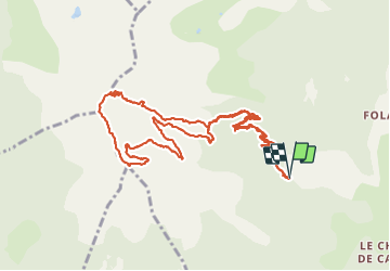

Length
13.5 km

Max alt
2610 m

Uphill gradient
964 m
Km-Effort
26 km

Min alt
1663 m

Downhill gradient
961 m
Boucle
Yes
Creation date :
2021-08-23 07:07:12.473
Updated on :
2021-08-23 20:06:35.284
6h51
Difficulty : Difficult

FREE GPS app for hiking
 SityTrail
IGN / Geographical institutes
SityTrail Plus
The world is yours!
About
Trail Walking of 13.5 km to be discovered at Provence-Alpes-Côte d'Azur, Hautes-Alpes, Embrun. This trail is proposed by Clo0413.
Positioning
Country:
France
Region :
Provence-Alpes-Côte d'Azur
Department/Province :
Hautes-Alpes
Municipality :
Embrun
Location:
Unknown
Start:(Dec)
Start:(UTM)
298422 ; 4939874 (32T) N.
Comments