


Galens (lac des) aller/retour 5km

Strabidja
User
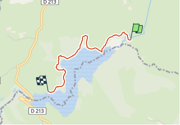

Length
2.4 km

Max alt
841 m

Uphill gradient
33 m
Km-Effort
2.8 km

Min alt
821 m

Downhill gradient
28 m
Boucle
No
Creation date :
2021-08-25 14:23:21.809
Updated on :
2021-08-25 15:06:59.93
36m
Difficulty : Easy

FREE GPS app for hiking
 SityTrail
IGN / Geographical institutes
SityTrail Plus
The world is yours!
About
Trail Walking of 2.4 km to be discovered at Occitania, Aveyron, Soulages-Bonneval. This trail is proposed by Strabidja.
Positioning
Country:
France
Region :
Occitania
Department/Province :
Aveyron
Municipality :
Soulages-Bonneval
Location:
Unknown
Start:(Dec)
Start:(UTM)
481952 ; 4945970 (31T) N.
Comments