


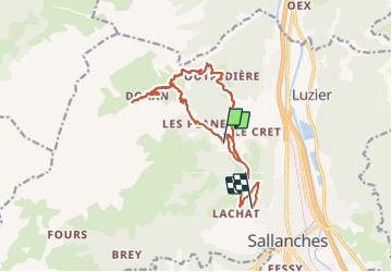
burzier-monts d'Oran - Burzier

JLBragard
User

Length
18.6 km

Max alt
1547 m

Uphill gradient
859 m
Km-Effort
31 km

Min alt
752 m

Downhill gradient
1078 m
Boucle
No
Creation date :
2021-08-26 07:49:29.788
Updated on :
2021-08-26 14:59:56.347
4h10
Difficulty : Difficult

FREE GPS app for hiking
 SityTrail
IGN / Geographical institutes
SityTrail Plus
The world is yours!
About
Trail Walking of 18.6 km to be discovered at Auvergne-Rhône-Alpes, Upper Savoy, Sallanches. This trail is proposed by JLBragard.
Positioning
Country:
France
Region :
Auvergne-Rhône-Alpes
Department/Province :
Upper Savoy
Municipality :
Sallanches
Location:
Unknown
Start:(Dec)
Start:(UTM)
314784 ; 5092093 (32T) N.
Comments