


trop Alexis

jphugon
User

Length
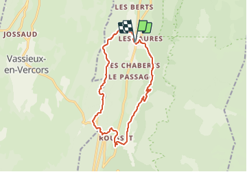
16.3 km

Max alt
1269 m

Uphill gradient
859 m
Km-Effort
28 km

Min alt
829 m

Downhill gradient
856 m
Boucle
Yes
Creation date :
2021-08-26 07:09:52.574
Updated on :
2021-08-26 16:39:56.657
7h59
Difficulty : Very difficult

FREE GPS app for hiking
 SityTrail
IGN / Geographical institutes
SityTrail Plus
The world is yours!
About
Trail Walking of 16.3 km to be discovered at Auvergne-Rhône-Alpes, Drôme, Saint-Agnan-en-Vercors. This trail is proposed by jphugon.
Description
départ hameaux des Faures
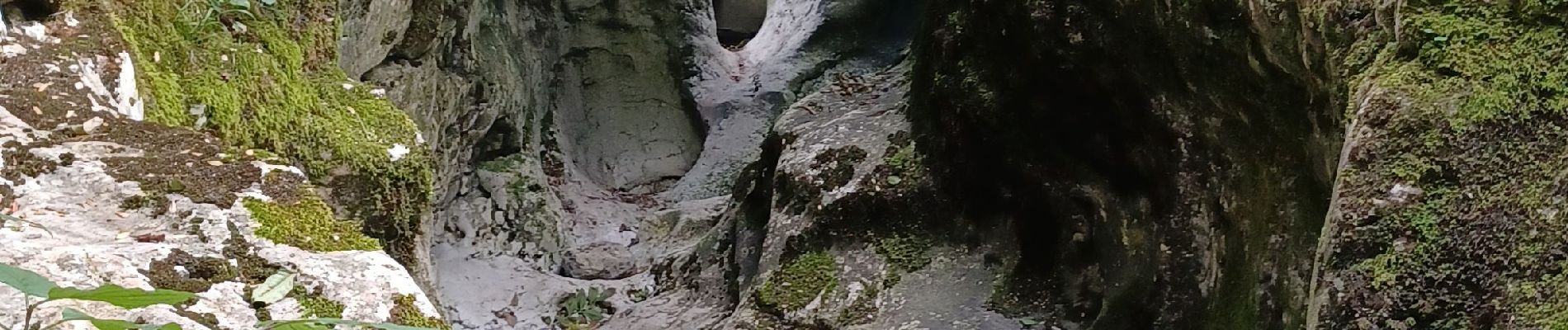
Photos


Positioning
Country:
France
Region :
Auvergne-Rhône-Alpes
Department/Province :
Drôme
Municipality :
Saint-Agnan-en-Vercors
Location:
Unknown
Start:(Dec)
Start:(UTM)
691506 ; 4975044 (31T) N.
Comments