


Le Morgonnet

Specialized77
User GUIDE
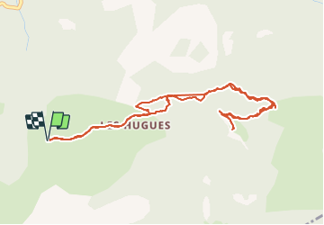

Length
5.9 km

Max alt
1740 m

Uphill gradient
349 m
Km-Effort
10.6 km

Min alt
1392 m

Downhill gradient
351 m
Boucle
Yes
Creation date :
2021-08-27 08:50:13.011
Updated on :
2021-08-27 12:11:46.508
2h46
Difficulty : Medium

FREE GPS app for hiking
 SityTrail
IGN / Geographical institutes
SityTrail Plus
The world is yours!
About
Trail Walking of 5.9 km to be discovered at Provence-Alpes-Côte d'Azur, Alpes-de-Haute-Provence, Pontis. This trail is proposed by Specialized77.
Description
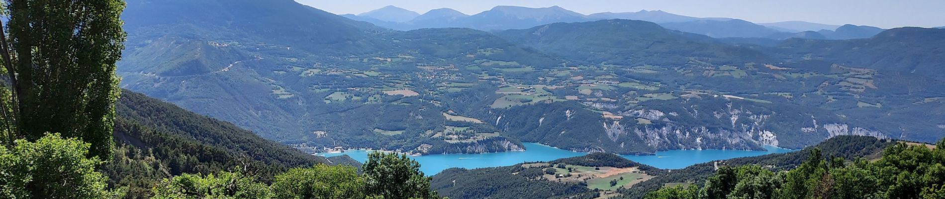
Panorama sur l'ensemble du lac de Serre Ponçon magnifique depuis les 2 belvédères du Morgonnet.
Photos


Positioning
Country:
France
Region :
Provence-Alpes-Côte d'Azur
Department/Province :
Alpes-de-Haute-Provence
Municipality :
Pontis
Location:
Unknown
Start:(Dec)
Start:(UTM)
289938 ; 4929545 (32T) N.
Comments