


La Crête du Lys TC

mitch1952
User
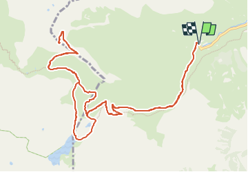

Length
16.4 km

Max alt
2428 m

Uphill gradient
1082 m
Km-Effort
31 km

Min alt
1359 m

Downhill gradient
1082 m
Boucle
Yes
Creation date :
2021-08-27 18:59:20.027
Updated on :
2022-06-08 14:23:58.649
7h00
Difficulty : Very difficult

FREE GPS app for hiking
 SityTrail
IGN / Geographical institutes
SityTrail Plus
The world is yours!
About
Trail Walking of 16.4 km to be discovered at Occitania, Hautespyrenees, Cauterets. This trail is proposed by mitch1952.
Description
IBP110 Cotation E5 T3 R3
Positioning
Country:
France
Region :
Occitania
Department/Province :
Hautespyrenees
Municipality :
Cauterets
Location:
Unknown
Start:(Dec)
Start:(UTM)
733316 ; 4751771 (30T) N.
Comments