


valcroissant mouton

collot
User
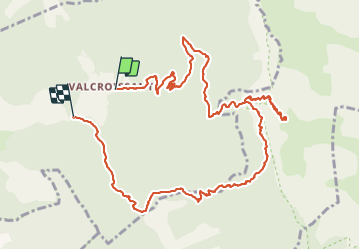

Length
13.3 km

Max alt
1848 m

Uphill gradient
1346 m
Km-Effort
31 km

Min alt
603 m

Downhill gradient
1404 m
Boucle
No
Creation date :
2021-08-29 07:10:44.422
Updated on :
2021-08-29 20:51:13.721
8h18
Difficulty : Difficult

FREE GPS app for hiking
 SityTrail
IGN / Geographical institutes
SityTrail Plus
The world is yours!
About
Trail Walking of 13.3 km to be discovered at Auvergne-Rhône-Alpes, Drôme, Die. This trail is proposed by collot.
Positioning
Country:
France
Region :
Auvergne-Rhône-Alpes
Department/Province :
Drôme
Municipality :
Die
Location:
Unknown
Start:(Dec)
Start:(UTM)
692572 ; 4957544 (31T) N.
Comments