Trail Walking Héricourt - Héricourt - Pierre Plate - Sentier de découverte - Photo

Héricourt - Pierre Plate - Sentier de découverte

 Bart2015
Bart2015

User

© OpenStreetMap contributors
Length
Length
12.3 km
Max alt
Max alt
501 m
Uphill gradient
Uphill gradient
329 m
Km-Effort
Km-Effort  
16.7 km
Min alt
Min alt
326 m
Downhill gradient
Downhill gradient
329 m
Boucle
Boucle
Yes
Creation date :
2021-08-31 12:12:27.471
Updated on :
2021-10-17 13:34:05.738

(0 Reviews)

Walking
Walking
2h20
Difficulty : Medium

Scan this QR Code to open this trail in the SityTrail application

FREE GPS app for hiking

Logo SityTrail SityTrail

IGN / Geographical institutes

Download SityTrail from the App Store Download SityTrail from Google Play

Logo SityTrail SityTrail World

The world is yours!

Download SityTrail from the App Store Download SityTrail from Google Play Download SityTrail on Huawei AppGallery

About

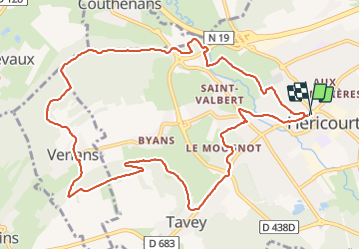
Trail Walking of 12.3 km to be discovered at Bourgogne-Franche-Comté, Haute-Saône, Héricourt. This trail is proposed by Bart2015.

Description

Randonnée au départ d'Héricourt pour découvrir ses chemins alentour. Elle emprunte une partie du sentier de découverte de Couthenans.
Bonne balade ...

Elevation profile

Photos

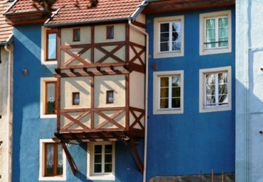
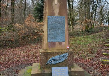
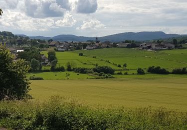
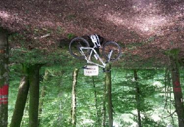
21 photos in total. Please click on a photo to see them all in the gallery.

Positioning

Country:
France
Region :
Bourgogne-Franche-Comté
Department/Province :
Haute-Saône
Municipality :
Héricourt
Location:
Héricourt
Start:(UTM)
331546 ; 5271599 (32T) N.

Trails nearby

Trail Walking Héricourt - La Pierre Plate - Héricourt - Photo
Walking
tracegps

Walking

Difficult
(3)
Héricourt, Bourgogne-Franche-Comté, Haute-Saône, France
12 km | 16.4 km-effort
3h 10min
Yes
Trail Walking Trémoins - TREMOINS - Photo
Walking
Marchebuissonniere

Walking

Medium
(1)
Trémoins, Bourgogne-Franche-Comté, Haute-Saône, France
8.3 km | 10.5 km-effort
3h 22min
Yes
Trail Walking Banvillars - Banvillars - forts du Hauts Bois et du Bois d'Oye - Photo
Walking
Bart2015

Walking

Very difficult
Banvillars, Bourgogne-Franche-Comté, Territoire-de-Belfort, France
16.3 km | 21 km-effort
4h 40min
Yes
Trail Walking Mandrevillars - Echenans et son fort - Photo
Walking
Bart2015

Walking

Very difficult
Mandrevillars, Bourgogne-Franche-Comté, Haute-Saône, France
14.8 km | 19.6 km-effort
4h 27min
Yes
Trail Walking Héricourt - Héricourt - fort Mont Vaudois - poudriére puis batterie d'Urcerey - Echenans - Photo
Walking
Bart2015

Walking

Medium
Héricourt, Bourgogne-Franche-Comté, Haute-Saône, France
16.4 km | 23 km-effort
3h 16min
Yes
Trail Mountain bike Couthenans - La raie du cul depuis Couthenans - Photo
Mountain bike
demipoil

Mountain bike

Medium
Couthenans, Bourgogne-Franche-Comté, Haute-Saône, France
22 km | 30 km-effort
2h 11min
Yes
Trail Walking Vyans-le-Val - vyans le val - Photo
Walking
Fillatre

Walking

Medium
Vyans-le-Val, Bourgogne-Franche-Comté, Haute-Saône, France
7 km | 9 km-effort
2h 5min
Yes
Trail Walking Trémoins - Tremois - Photo
Walking
Fillatre

Walking

Medium
Trémoins, Bourgogne-Franche-Comté, Haute-Saône, France
6.1 km | 7.9 km-effort
2h 0min
Yes
Trail sport Chagey - 2023-11-16_14h48m52_SityTrail - 3868562 - genechier-11x23-petit-circuit-dxhiver - Photo
sport
SOYARD

sport

Very easy
Chagey, Bourgogne-Franche-Comté, Haute-Saône, France
8.1 km | 11 km-effort
Unknown
Yes


Close
My subscriptions