


toue de doumblas et toue labassa

cemoi
User
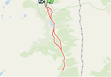

Length
7.4 km

Max alt
1764 m

Uphill gradient
312 m
Km-Effort
11.5 km

Min alt
1476 m

Downhill gradient
312 m
Boucle
Yes
Creation date :
2021-09-01 16:45:57.56
Updated on :
2021-09-01 16:48:16.543
2h37
Difficulty : Medium

FREE GPS app for hiking
 SityTrail
IGN / Geographical institutes
SityTrail Plus
The world is yours!
About
Trail Walking of 7.4 km to be discovered at Occitania, Hautespyrenees, Arrens-Marsous. This trail is proposed by cemoi.
Positioning
Country:
France
Region :
Occitania
Department/Province :
Hautespyrenees
Municipality :
Arrens-Marsous
Location:
Unknown
Start:(Dec)
Start:(UTM)
722888 ; 4751438 (30T) N.
Comments