


RG20 Corse étape 2

laurentnecca
User
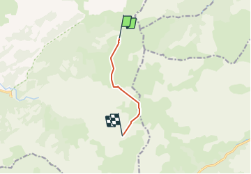

Length
5 km

Max alt
2009 m

Uphill gradient
669 m
Km-Effort
14.2 km

Min alt
1490 m

Downhill gradient
730 m
Boucle
No
Creation date :
2021-09-03 05:42:14.296
Updated on :
2021-09-04 08:34:41.44
8h55
Difficulty : Difficult

FREE GPS app for hiking
 SityTrail
IGN / Geographical institutes
SityTrail Plus
The world is yours!
About
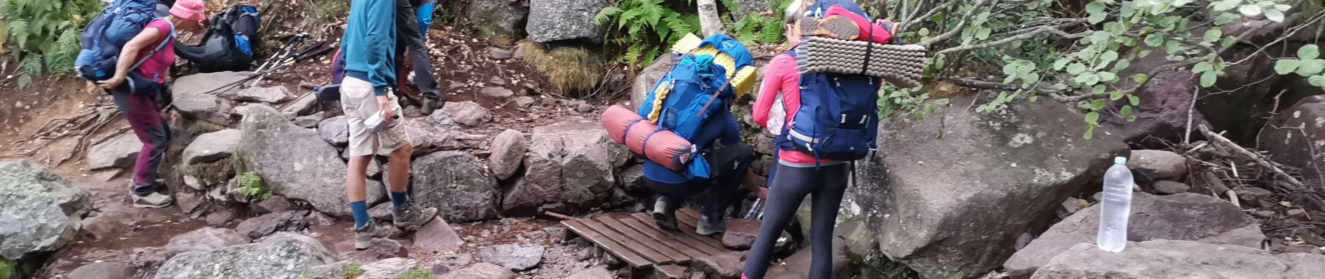
Trail Walking of 5 km to be discovered at Corsica, Haute-Corse, Calenzana. This trail is proposed by laurentnecca.
Photos


Positioning
Country:
France
Region :
Corsica
Department/Province :
Haute-Corse
Municipality :
Calenzana
Location:
Unknown
Start:(Dec)
Start:(UTM)
492348 ; 4701269 (32T) N.
Comments