


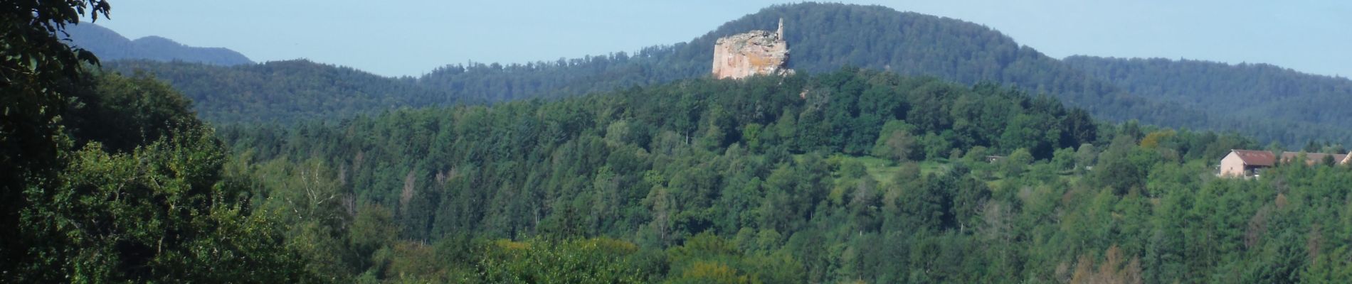
Autour du Fleckenstein

VANDERPUTTENMi
User GUIDE
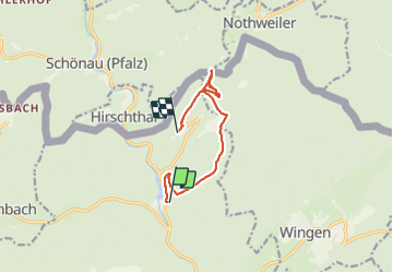

Length
8.4 km

Max alt
544 m

Uphill gradient
386 m
Km-Effort
13.1 km

Min alt
207 m

Downhill gradient
262 m
Boucle
No
Creation date :
2021-09-05 07:35:05.558
Updated on :
2021-10-02 13:30:53.59
2h27
Difficulty : Difficult

FREE GPS app for hiking
 SityTrail
IGN / Geographical institutes
SityTrail Plus
The world is yours!
About
Trail Walking of 8.4 km to be discovered at Grand Est, Bas-Rhin, Lembach. This trail is proposed by VANDERPUTTENMi.
Photos

Positioning
Country:
France
Region :
Grand Est
Department/Province :
Bas-Rhin
Municipality :
Lembach
Location:
Unknown
Start:(Dec)
Start:(UTM)
410129 ; 5431676 (32U) N.
Comments