


Lichtenberg

Claudele
User
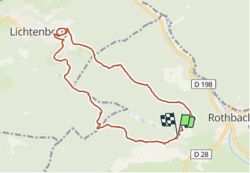

Length
9.6 km

Max alt
383 m

Uphill gradient
341 m
Km-Effort
14.1 km

Min alt
198 m

Downhill gradient
340 m
Boucle
Yes
Creation date :
2021-09-05 07:45:31.484
Updated on :
2021-09-05 16:30:23.007
4h30
Difficulty : Easy

FREE GPS app for hiking
 SityTrail
IGN / Geographical institutes
SityTrail Plus
The world is yours!
About
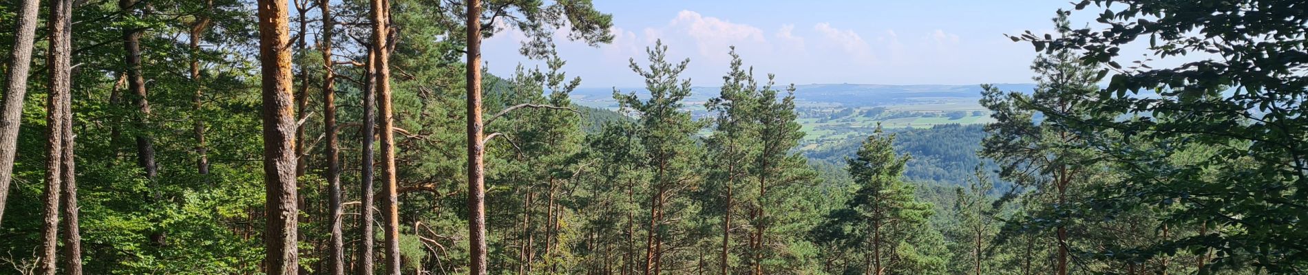
Trail Walking of 9.6 km to be discovered at Grand Est, Bas-Rhin, Rothbach. This trail is proposed by Claudele.
Photos


33 photos in total. Please click on a photo to see them all in the gallery.
Positioning
Country:
France
Region :
Grand Est
Department/Province :
Bas-Rhin
Municipality :
Rothbach
Location:
Unknown
Start:(Dec)
Start:(UTM)
391236 ; 5417858 (32U) N.
Comments