


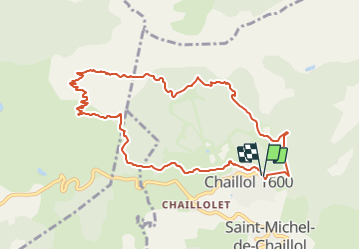
Le Balcon du Champsaur

raymondfn
User

Length
10.4 km

Max alt
1996 m

Uphill gradient
500 m
Km-Effort
17.1 km

Min alt
1587 m

Downhill gradient
498 m
Boucle
Yes
Creation date :
2021-09-07 12:43:45.289
Updated on :
2021-09-07 14:00:52.696
3h53
Difficulty : Difficult

FREE GPS app for hiking
 SityTrail
IGN / Geographical institutes
SityTrail Plus
The world is yours!
About
Trail Walking of 10.4 km to be discovered at Provence-Alpes-Côte d'Azur, Hautes-Alpes, Saint-Michel-de-Chaillol. This trail is proposed by raymondfn.


Positioning
Country:
France
Region :
Provence-Alpes-Côte d'Azur
Department/Province :
Hautes-Alpes
Municipality :
Saint-Michel-de-Chaillol
Location:
Unknown
Start:(Dec)
Start:(UTM)
275416 ; 4952319 (32T) N.
Comments